

krabi travel
Coastal Roads from Ao Nang to Klong Muang
A relaxed ride along Krabi's coastline — sea views, quieter beaches and easy riding north from Ao Nang.
6 min
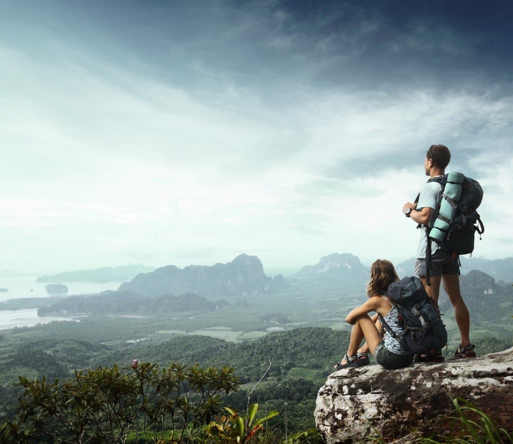
Explore Krabi
Krabi’s landscape is defined by limestone mountains, mangrove forests, palm plantations and hundreds of islands rising from the Andaman Sea. Some viewpoints can be reached directly from the mainland by motorbike, while others require hiking, climbing or travelling by boat.
The following guide covers six distinctive viewpoints. It is written for travellers starting on the Krabi mainland and explains how to reach each location, the best time to visit, the physical difficulty and the main safety considerations.
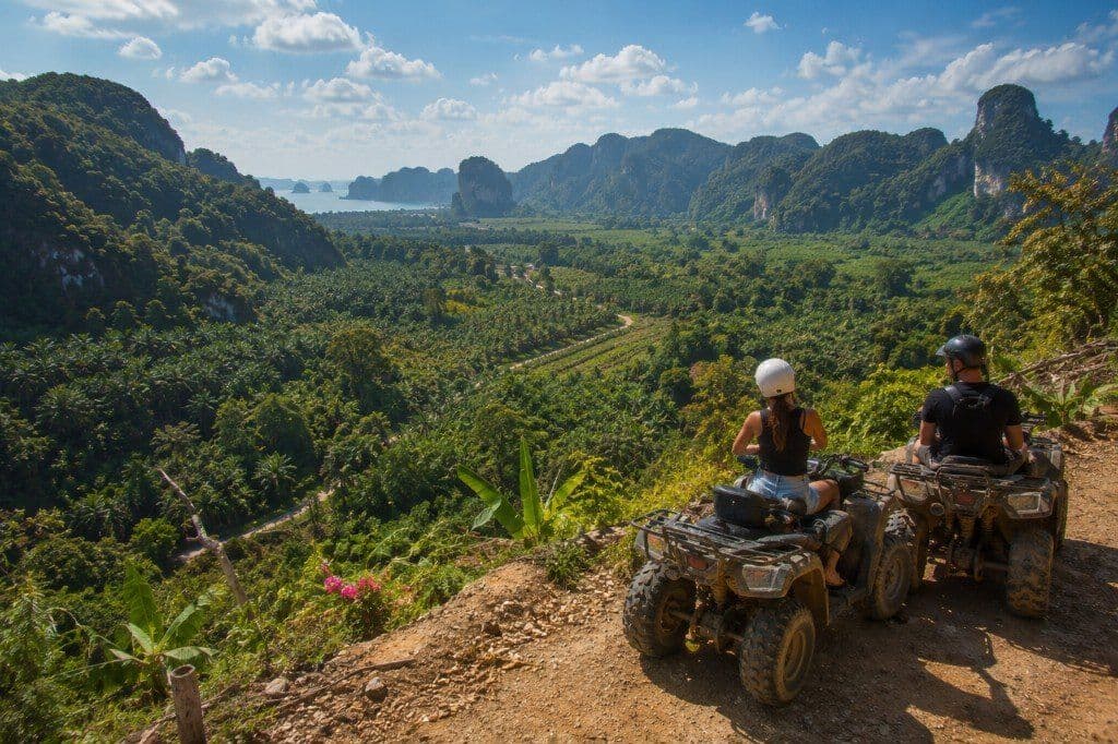
ATV Nature Viewpoint is located in the Khao Thong area north of Ao Nang. Despite its name, this is not simply a roadside viewpoint where visitors park, take a photograph and leave. It is primarily an organised outdoor activity in which visitors ride ATVs through plantations, forest tracks, muddy trails and hilly terrain before reaching elevated viewpoints.
From Ao Nang, the site can be reached by travelling north through Nong Thale towards Khao Thong. A Krabi motorbike rental is useful for reaching the activity centre, although many booked ATV packages also provide transfers from selected hotels. Once at the centre, visitors normally receive a safety briefing, protective equipment and basic instructions before following a guide along the off-road route. Current activity listings describe sessions of approximately one hour, although longer packages may be available.
The viewpoint overlooks palm plantations, green countryside and the dramatic limestone mountains of northern Krabi. Depending on the route and visibility, some tours also provide distant views towards the coast and offshore islands. Reviews frequently mention the changing terrain, steep slopes, muddy sections and opportunities to stop for photographs. Beginners are generally accepted, but participants should listen carefully to the guide and avoid travelling faster than their experience allows.
Morning is normally the most comfortable time to visit because temperatures are lower and the ground may be easier to navigate before afternoon rain. Late afternoon can provide softer light, but availability depends on the operator’s schedule. During the rainy season, the trails may become considerably muddier and more slippery. That can make the ride more adventurous, but also more physically demanding.
Wear closed shoes and clothing that can become dirty. Sunglasses or eye protection may help with dust, while insect repellent can be useful around plantation and forest areas. Riders should keep both hands on the controls and leave sufficient distance between vehicles.
The ATV Nature Viewpoint is recommended for couples, groups and adventurous families who want an activity rather than a conventional lookout. It is less suitable for visitors with back, neck or mobility problems. Exact operating hours, age restrictions and prices vary by package; confirm schedules and pricing with the operator before you travel.
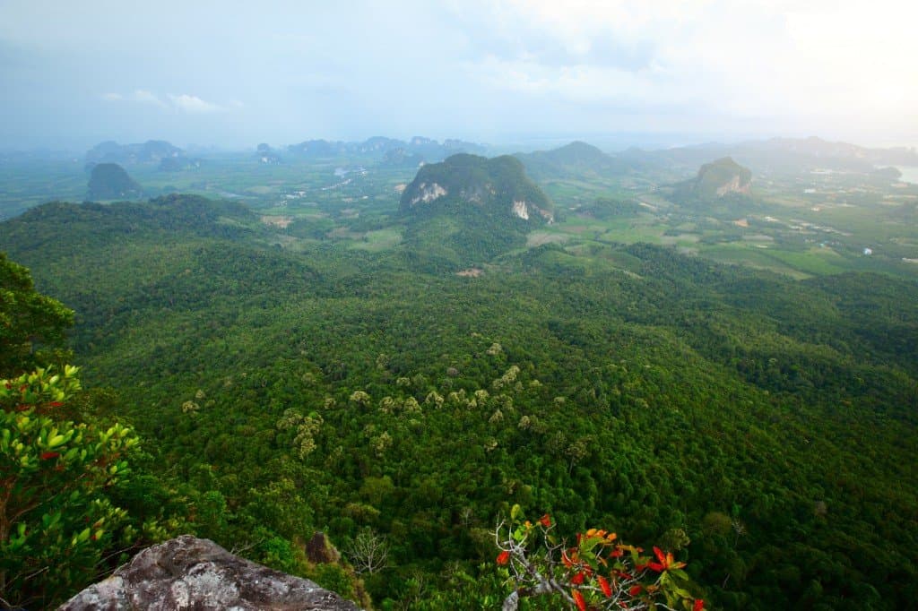
Hang Nak Viewpoint is reached by following the Ngon Nak Nature Trail, also widely known as the Dragon Crest or Dragon’s Crest trail. The trailhead is near Tubkaek Beach, northwest of Ao Nang, and can be reached entirely by road from the mainland.
Using a Krabi motorbike rental, visitors can travel from Ao Nang through Noppharat Thara and Khlong Muang before continuing towards Tubkaek. The entrance is located near the northern end of the Tubkaek area. Motorbikes must be left at the trailhead; the viewpoint itself is accessible only on foot.
Hang Nak is one of the most demanding established hikes in Krabi. Descriptions of the trail vary slightly, but visitors should expect several kilometres of sustained uphill walking through humid forest, followed by the same route back down. The summit is approximately 500 metres above sea level and offers extensive views over forest, agricultural land, limestone formations and the islands off Krabi’s coast.
Allow approximately four to six hours for the full experience, including rest stops and time at the viewpoint. Fit hikers may complete it faster, but the tropical heat can make the climb more difficult than the distance suggests. Start early in the morning to avoid the strongest heat and to leave a safe margin before the trail closes. Entry procedures and permitted starting times can change, so visitors should check with staff at the trailhead on arrival.
Carry sufficient drinking water, light food and basic rain protection. Proper walking shoes are strongly recommended. The trail can become muddy, and exposed roots, loose stones and wet leaves create slipping hazards. Visitors should not begin during thunderstorms or heavy rain.
The famous photographs associated with Hang Nak often show a projecting rock ledge. Visitors should not attempt risky poses or move beyond maintained areas simply to recreate social-media images. Conditions at cliff edges can be dangerous, particularly when the rock is wet.
The cooler months between November and February are generally the most comfortable. March and April can be exceptionally hot, while the rainy season may bring mud, reduced visibility and temporary access restrictions.
Hang Nak is recommended for active visitors with reasonable fitness and sufficient time. It is not a casual sightseeing stop and is unsuitable for anyone who cannot manage prolonged climbing and a steep descent. The reward is one of the broadest mainland panoramas in the Krabi area.
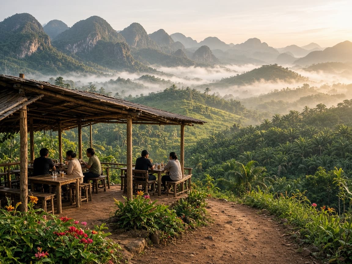
Kuan Nom Saow is a community-style viewpoint, restaurant and camping area in Khao Thong, north of Ao Nang. It provides a very different experience from Hang Nak: the emphasis is on quiet rural scenery, food, coffee and sunrise views rather than a long wilderness hike.
Travellers can reach the general area from the mainland by following the road north through Nong Thale into Khao Thong. However, the final approach is steep and can be rough. Local visitor reports recommend using a motorbike or suitable vehicle, and some describe the route as rocky or difficult to locate. The Google Maps pin should be followed carefully, particularly at small rural junctions.
The attraction overlooks forests, palm plantations and a striking line of limestone mountains. During humid or rainy periods, low cloud and morning mist may settle between the peaks, creating a landscape that resembles a small inland sea of fog. The name is associated with the shape of the surrounding hills, which local people have compared to a woman’s breasts.
Sunrise is the most popular time to visit. Current travel listings commonly show hours of approximately 6:30 a.m. to 6:30 p.m., but confirm locally before you travel. Arriving near 6:30 a.m. provides the best chance of cooler air, softer light and morning mist. Sunset may also be attractive, although the main mountain-facing view is particularly well known in the morning.
Visitors can normally purchase breakfast, coffee or other simple meals while enjoying the scenery. Reviews praise the relaxed atmosphere, friendly management and panoramic restaurant setting. Camping has also been offered; confirm current camping arrangements directly before travelling.
A Krabi motorbike rental is practical for the journey, but riders should be cautious on the final incline. Use low speed, avoid sudden braking on gravel and do not attempt the road during heavy rain when traction is poor. The descent may be more difficult than the climb.
Kuan Nom Saow is recommended for photographers, couples, families and visitors who want a peaceful viewpoint without a strenuous multi-hour hike. It is also an excellent choice for anyone interested in seeing Krabi’s agricultural and mountain landscapes rather than only its beaches.
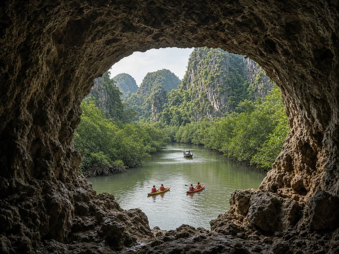
The Window Cave of Ancient Cavemen is located in Ao Luek District, north of central Krabi. The Google Maps location places it in the Ao Luek Noi area near Khao Garos, mangrove waterways and limestone formations. Although it is geographically connected to the mainland, the cave is normally experienced as part of a boat or kayaking journey through the mangroves rather than by simply driving to its map pin.
From Ao Nang or Krabi Town, visitors can travel north by Krabi motorbike rental towards Ao Luek and the departure area used by local boat and kayak operators. The precise pier or meeting point depends on the tour company. Visitors should not assume that the Google Maps coordinate marks a normal road entrance, as the final section involves waterways and limestone terrain.
Organised excursions commonly combine the Window Cave with Khao Garos, mangrove kayaking, local fishing communities and other caves or rock formations. The route may begin with a long-tail boat journey before transferring to kayaks for the narrower channels. Current tour listings specifically include the cave as part of Khao Garos long-tail boat and mangrove-kayaking experiences.
The cave receives its name from a large natural opening in the limestone, which frames the mangrove forest and surrounding cliffs like a window. The scenery is atmospheric rather than elevated: visitors look outward through the rock formation while surrounded by water, vegetation and towering cave walls.
Morning is normally the best time to go. Temperatures are cooler, the light entering the cave can be attractive and there is more time to complete the water journey before afternoon rain. However, access may depend on tides, weather and the operator’s chosen route. The tour company should confirm whether conditions are suitable.
Wear clothing that can become wet, secure phones in a waterproof case and use the provided life jacket. Visitors should avoid touching cave formations, disturbing wildlife or separating from the guide. Limestone can be sharp, while mud and wet surfaces around landing areas may be slippery.
The Window Cave is recommended for nature lovers, photographers and visitors interested in kayaking and quieter parts of Krabi. It is not a conventional hilltop viewpoint, but the framed view through the cave makes it one of the province’s most distinctive natural perspectives.
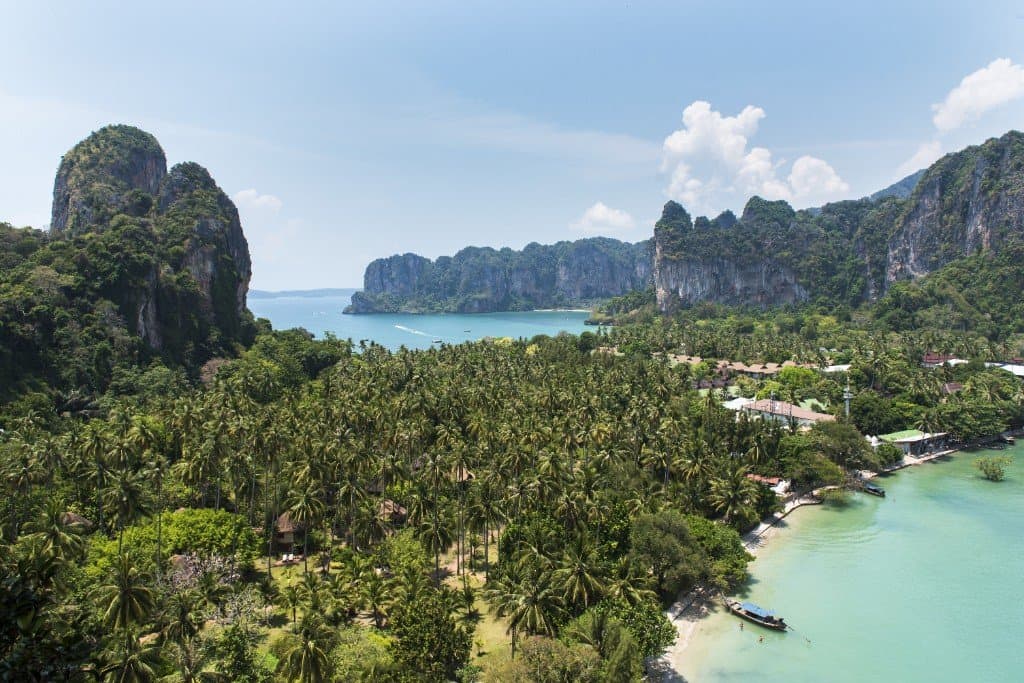
East Railay Viewpoint is located on the Railay peninsula, which is attached to the mainland but isolated from the road network by limestone cliffs. Travellers starting in Ao Nang must therefore leave their motorbike on the mainland and continue by long-tail boat.
The usual journey begins at Ao Nang Beach, where long-tail boats operate to Railay. Boats also depart from Ao Nam Mao, which generally provides access to Railay East. Service frequency depends on weather, sea conditions and passenger demand. Visitors using an Ao Nang or Krabi motorbike rental should park legally near the departure point and secure valuables before boarding.
The recognised trail begins on the walking route between Railay East and Phra Nang Beach. It is not a normal staircase. The ascent involves steep red earth, limestone, tree roots and fixed ropes. In dry conditions, fit visitors may reach the viewpoint in approximately 20–30 minutes, but the exact time depends heavily on congestion and climbing confidence.
The viewpoint overlooks both sides of the Railay peninsula. Railay East, its mangroves and pier appear on one side, while the beach, resorts, limestone walls and blue water of Railay West extend across the other. It is one of the clearest places to understand Railay’s unusual geography.
Early morning offers cooler conditions and fewer people on the climbing route. Late afternoon may provide beautiful light, but visitors must leave enough time to descend and catch a return boat. The trail should be avoided during or immediately after rain. The red clay becomes extremely slippery and can cover clothing, hands and footwear.
Closed shoes with strong grip are essential. Flip-flops are unsuitable. Visitors must be capable of supporting their body weight while using ropes and natural handholds. The descent can be more difficult than the ascent because hikers must lower themselves down steep, muddy sections while other people are climbing upward.
The viewpoint is recommended only for physically capable visitors who are comfortable with steep scrambling. It is not suitable for small children, people with mobility limitations or anyone uncomfortable with heights. The nearby lagoon route is even more difficult and should not be confused with the main viewpoint turn-off.
Boat operations and trail conditions can change without notice. Check the return-boat arrangements before climbing, especially outside the high season.
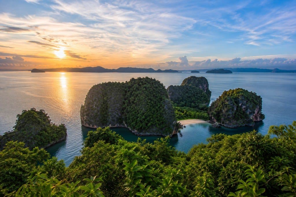
Koh Hong Viewpoint is the second location in this guide that requires a boat from the Krabi mainland. Koh Hong lies offshore within Than Bok Khorani National Park and cannot be reached by road or public ferry in the same way as a permanently inhabited island.
Visitors normally join a Hong Islands tour or arrange a private long-tail boat or speedboat from Ao Nang, Noppharat Thara, Khlong Muang or another authorised departure point. A Krabi motorbike rental can be used to reach the pier, but the motorcycle remains on the mainland.
On arrival at Koh Hong, visitors can access the viewpoint from the island’s main visitor area. The Tourism Authority of Thailand confirms that the structure contains 419 iron steps and leads to a 360-degree panorama. The platform sits approximately 109 metres above sea level and looks across the Hong archipelago, Phang Nga Bay, limestone islands and turquoise channels.
The climb generally takes around 20–30 minutes at a comfortable pace, although fit visitors may be faster. Rest platforms are positioned along the route, and much of the staircase passes through vegetation. Nevertheless, the heat and humidity make the ascent tiring.
The best time to visit is early morning, before the largest group tours arrive and before the staircase becomes hot and crowded. Independent visitor reports repeatedly describe the island as quieter in the morning. Late afternoon can also be attractive, but most visitors are restricted by their boat itinerary and national-park operating schedule.
Bring water and wear secure footwear. Walk slowly on wet steps, use the handrails and allow faster visitors to pass safely. People with knee, heart or serious mobility problems may prefer to enjoy the beach and lagoon instead.
The viewpoint is usually visited alongside Koh Hong’s beach, snorkelling areas and enclosed lagoon. National-park admission may be charged separately from the boat-tour price, so travellers should confirm whether the fee is included before booking.
Koh Hong Viewpoint is recommended for almost anyone with moderate fitness who wants a high island panorama without completing a difficult jungle hike. Compared with Hang Nak or East Railay, the maintained staircase makes access more straightforward, while the surrounding island scenery makes it one of Krabi’s most rewarding viewpoints.
These six viewpoints offer very different experiences. Kuan Nom Saow is the easiest place for a relaxed breakfast and sunrise. ATV Nature Viewpoint combines scenery with an organised activity. Hang Nak provides the most substantial mainland hike, while the Window Cave is explored through Krabi’s northern mangrove waterways.
East Railay and Koh Hong both require a boat from the mainland. East Railay involves a short but difficult rope-assisted scramble, while Koh Hong uses a maintained staircase.
Visitors travelling by Krabi motorbike rental should check the weather, begin long journeys early and avoid returning on unfamiliar rural roads after dark. Never leave passports, cash or electronics unsecured on a parked motorcycle while taking a boat trip.
Gallery
Things to do
Blog articles
Viewpoints
Explore this area by scooter — practical notes and booking help from our team.
A relaxed ride along Krabi's coastline — sea views, quieter beaches and easy riding north from Ao Nang.
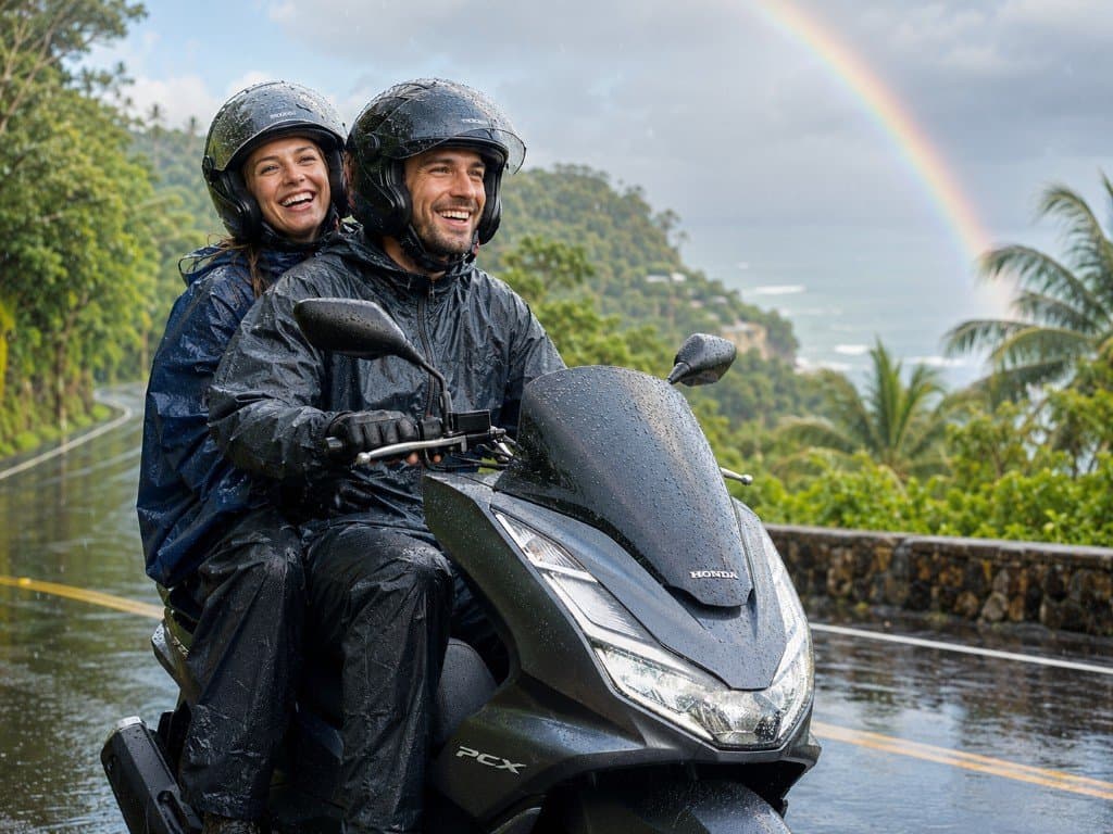
Krabi’s dry and rainy seasons, monthly temperature and rainfall patterns, and how weather affects beach trips, island tours and motorcycle rental year-round.
Explore the area